The Lyme Maze Game

You don't want to turn downhill back toward Axminster, so you cross this highway (called B 3261) so as to go up it rightward. (But notice the "footpath" sign just opposite the lane by which you have emerged. The path begins as a mere part of the grass verge, running between the road and a field fence, but stealthily it peels off, the separating grass becoming wider until it is succeeded by trees and the path disappears along its own route. One day I'll find out where it leads. —Well, one day I did find out, and of course it was a way through to—) On the main road, you don't have to endure more than three hundred yards before it rises to meet an even noisier highway swooping past.
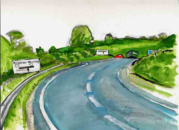
The highway ahead is the A 35. And there's the green Number 31 bus from Lyme, making the turn to come down to Axminster. The T-junction is pictured in a large sign: Dorchester left, Honiton right. The sign is repeated in a second version. Motorists rushing up to the junction may not notice that the first version differs, showing a minor twig to the left called Cook's Lane—indeed they may fail to notice Cook's Lane itself. The situation—the road layout, as it's called in England—is interesting, having been reconfigured past easy recognition by modern engineers in the 1990s. Cook's Lane is the continuation of the old road that comes through the hamlet of Woodbury. The original crossroads, truncated, is hidden in the dell down to the right; the old Axminster-to-Lyme road, crossing at an oblique angle, passed somewhere under you to come up on the line of what is now the upper A 35; since the A 35 slides by at a higher level, the road you are on has been brought up to it on an embankment, under which the older roads are buried. You don't want to get on that roaring A 35, so you turn off down little Cook's Lane, which seems to aim in the same direction. |
