|
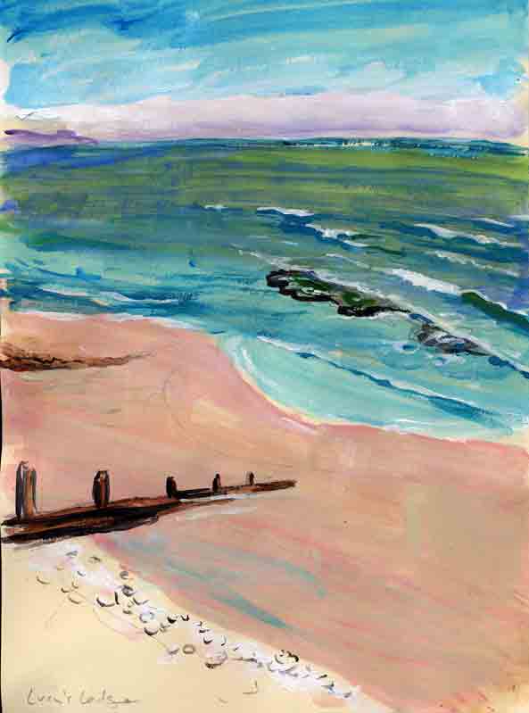
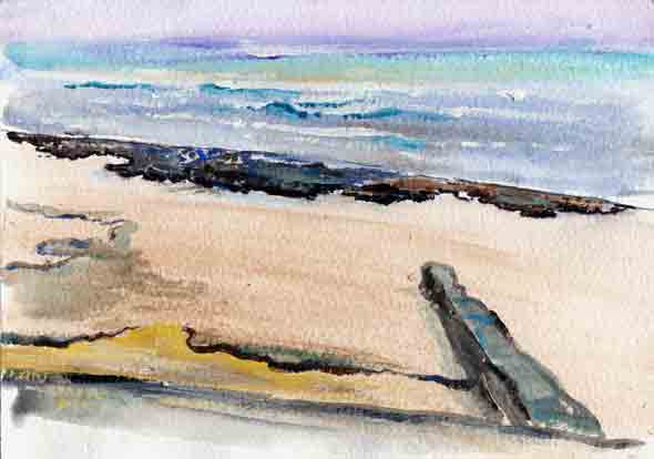
Lucy's Ledge, off the middle of the beach, is an islet of rocks high enough to show except when the tide is high. It remains as the only natural feature visible along the whole front of the town.

And there used to be a jetty, Lucy's Jetty, pointing out toward the ledge. It was covered by the shingle beach built in 2006.
And formerly Lucy's Ledge was echoed by a second and smaller ledge, a lower rock-layer outcropping higher up the beach. It is under the new shingle.

As to who Lucy was, there are conflicting and inadequate tales. She may have been a girl who played here, daughter of the Borough Surveyor. Or she may have been a boat, moored here by the owner of South Cliff in Pound Street. Perhaps most passers-by picture her as something like the Little Mermaid in Copenhagen's harbour.
“Ledge” in this region means the visible part of a rocky layer, only a few feet thick, and usually not quite horizontal but sloping gently toward the east-southeast. Lucy's Ledge is a fragment of such a layer, so that, as you can see, it slopes away toward the seaward side, but on the landward side breaks off in a scarp, blocks of which are getting ready to fall. So it looks to me like a microcosm of the geology of Dorset, indeed of the whole of southeastern England: layers broken off at scarps on the northwest, and sloping down toward the southeast.
When we come in sight of the sea of a morning, we remark: “No Lucy's Ledge yet” or “Look, Lucy's Ledge is just breaking the surface” — it's a way of expressing the state of the tide.
As a tide lowers, there comes the stage when waves begin to break as they stumble over this submerged ledge, thus revealing its existence beneath the surface. At a later stage, each wave breaks as it arrives at the ledge, and the line of breaking — the line of folding-over water — runs away progressively along that wave, westward, along the smoother beach.
Most of the time when Lucy's Ledge shows it remains an island; young explorers have to wade to it — the deepest water is just in front of it, scooped out under the scarp — and then they search among the rock pools and perhaps make up better stories as to who Lucy was.
When the tide recedes farther, sand reaches to the right (west) corner of the ledge. Sometimes the tide goes out so far that many other zones of rock become visible, mostly to the left of Lucy. At an extreme low tide (as on the afternoon of 2012 Feb 10), you can see, especially if looking over the whole scene more broadly from up in the gardens, that Lucy's Ledge is really just a fragment of a larger complex of rocks that must include the greater ledges to the east. The Cobb itself is founded on rocks; rocks sometimes appear out to the southwest of it; yet farther out are always-submerged rocks that that sometimes cause breaking waves and are marked by a buoy light. Lucy's Ledge would be connected to the eastern ledges, but that the area in between is fissured into ridges running outward from the mouth of the river. You can sense that, centuries ago, more of this wilderness of rocks was above water, getting between the town and the sea. It is apparent why this apron of rocks encumbering the front of the town made the river mouth impossible as a port, so that the Cobb harbour had to be scooped out instead.

|
