The Lyme Maze Game

A beach made of rounded pebbles. An infinity of pebbles stretches to left and right, and up to the nearby horizon. Under each roller as it breaks over them and drags them forward they utter a hollow roar, haw, then heshsh as the sliding foam rolls them back outward. Sometimes haw and heshsh overlap like the tenor and treble parts of a choir of pebbles. Shingle of this kind is locally called chesil (an old word surviving in Dorset dialect). In fact this is the famous seventeen-mile Chesil Beach, or Chesil Bank. After your watery ordeal, you may be less than interested in the lore of Chesil Bank—you'd just like to know where you are. But you could, by looking down. This is an accumulation of (let's guess) three hundred thousand million pebbles, mostly flint and chert, built by a single storm according to legend, but according to geologists transported over only a few hundred thousand years from the coasts of south Devon. And the pebbles are noticeably sorted by size, from half an inch at the western end to as much as six inches at the east. A first thought might be to connect both the bringing of the pebbles from the southwest, and their sorting, with the prevailing current, which comes from that direction; but pebbles don't float in a current. It must instead be the waves, the strongest of which also come from the southwest. The breaking waves, rolling the pebbles around, must shift them differentially, though nobody is quite sure of the mechanism. It may be that the strongest waves, arriving from the southwest under the stronger storms, can budge pebbles of all sizes eastward, whereas weaker storm-waves from the less common south-eastern storms are able to nudge only the smaller pebbles back west. At any rate, a shipwrecked fisherman crawling ashore somewhere along the seventeen miles of Chesil Bank can tell where he is by the size of the stones his hands clutch. So it is said. The rampart of chesil is thirty feet high and two hundred yards wide; but in the larger view it is a seventeen-mile thread, departing gradually from the land in a very smooth and gentle curve southeastward to touch a great block of limestone, the "Isle" of Portland, which it renders not quite an island. It is like a long smooth tendon connecting a calf to a heelbone. Behind the bank lies Britain's longest lagoon, called the Fleet, haven to birds.
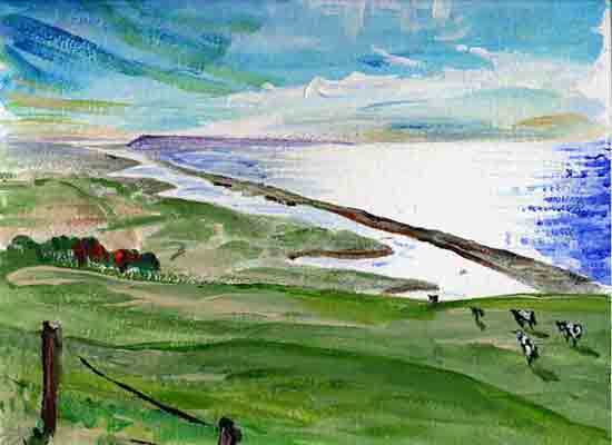
(Fleet and Chesil and Portland, seen in the morning from Wears Hill above Abbotsbury.) Well, where are you? The pebble you have picked up is medium-small: you are not far from the beginning, where Chesil Bank is still attached to the land. Stumbling over the top of the Bank and down past the Swannery at the marshy head of the Fleet, you will find the village of Abbotsbury, and somewhere surely to get warm, since it is known for being one of the most sheltered spots on the English coast, with subtropical gardens, where perhaps (after a rest and the loan of some clothes) you will enjoy one of the summer-evening operas on the lawn, and may not even think of returning to Lyme. Oh, maybe one day you take the X53 bus that tours along the coast from Weymouth all the way to Exeter. On the top of the double-decker bus you ascend the chalk downs west of Abbotsbury, with glorious views over Lyme Bay, and pass through little places called West Bexington and Swyre and Puncknowle (pronounced punnel), and then Burton Bradstock and the town of Bridport, and Chideock and Morcombelake, and come again to a well-remembered scene—
|
